Langpar Fm
Type Locality and Naming
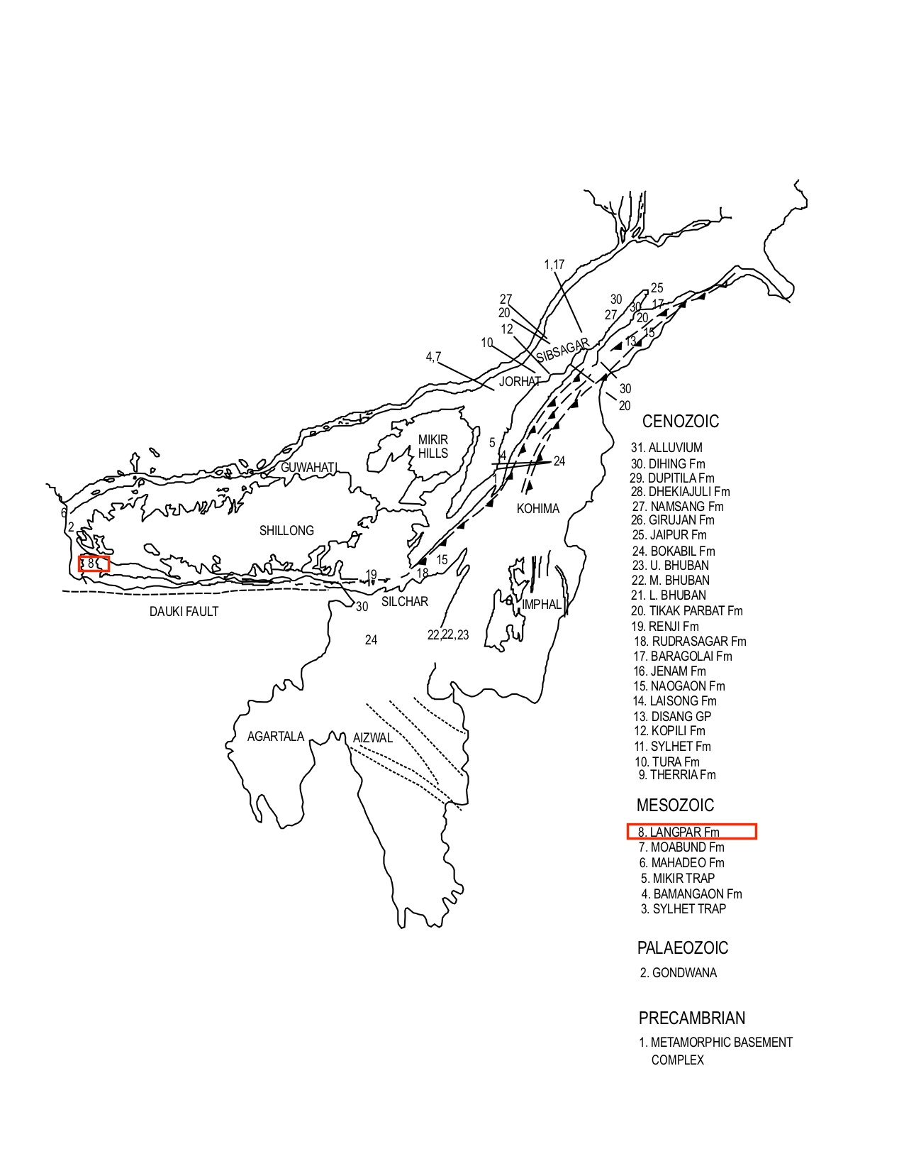
Type section is in the Langpar spur, south of Mawsami in Khasi Hills. Its thickness is 75 m. [Original Publication: Medlicott, H. B., 1869. Geological Sketch of the Shillong Plateau, Mem. Geol. Surv. India vol. VII, pt. 1, pp. 151-207.]. Reference section: Um Sorhyngkew River Section, its thickness is 151 m.
Synonyms: Medlicott (1869) originally described the ‘Langpar band’ comprising pale sandstone with plant remains. Ghosh (1940), Mathur and Evans (1964) have used the term ‘Langpar stage’. Chakraborty et al., (1974) have designated it as the Langpar Formation, (Pandey and Dave, 1998).
[Figure 1: Formation stratotypes of North East Basins (modified after Pandey and Dave, 1998)]
Lithology and Thickness
Sandy limestone. Type section lithology: Medlicott (1869), described Langpar Formation as sandy limestones with calcareous and carbonaceous shales with minor fine-grained sandstone. Reference section lithology: In Um Sorhyngkew river section, it consists of shale with alternations of impure limestone, calcareous and non-calcareous sandstone. The dark grey shales are occasionally calcareous and silty with carbonaceous matter. The sandstones are usually thin to occasionally thick bedded, fine grained and grey to dark grey in color. Thin coal bands and yellowish siltstone, claystone bands are also present towards top. This formation being shale-dominated is usually exposed on the flanks of hills capped by the overlying limestones, or in the stream beds, (Deshpande et al., 1993).
Relationships and Distribution
Lower contact
Conformably overlies the Mahadeo Fm.
Upper contact
Conformably overlying by the Therria Fm of the Jaintia Gr.
Regional extent
Khasi & Jaintia Hills: It is exposed between Umiew River in the west and Lubra River in south Shillong Plateau. The formation is predominantly a shaly sequence with some siltstone/sandstone and limestone intercalations. It has been observed that the sand content increases both towards west and east in relation to Um Sohryngkew river section.
GeoJSON
Fossils
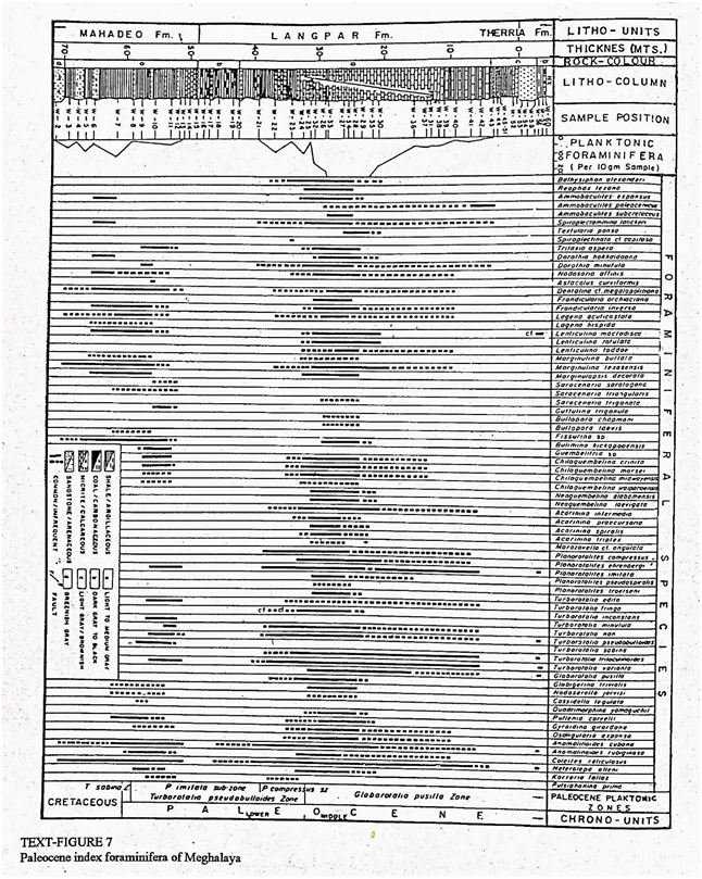
Pandey (1981) reported Guembelitria cretacea, Chiloguembelina sp., Subbotinia sp., Globigerina and Turborotalia eugubina etc from Um Sorhyngkew River Section, Meghalaya.
[Figure 2: Paleocene index foraminifera of Meghalaya (after J.Pandey and A. Dave, 1996)]
Age
Depositional setting
Iridium enrichment at Cretaceous/Tertiary boundary in Meghalaya, Bhandari et al., 1987. Marginal to open marine environments.
Additional Information

